Posts

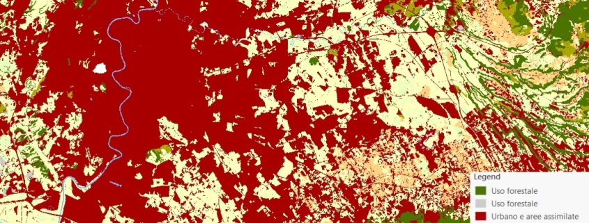
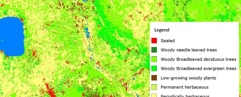
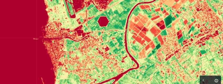
Health and density vegetation map (NDVI)

The NDVI index is a measure of vegetation vigor and can be used to easily distinguish green vegetation from bare soil.

Availability: Available

Data Type: raster

Delivery Method: API, Direct download

Compatible with: ArcGIS Enterprise, ArcGIS Online, ArcGIS Pro, QGIS

Piattaforms: Desktop, Web

System Requirements: None

Version: 1.0

Coverage Area: Italia

Data Format: Tiff, GeoTiff, .jpg, Excel, csv, .pdf

Sistema di riferimento: WGS 1984 UTM Zone 32N (EPSG: 32632)

Sources: Sentinel-2 Copernicus Programe

Land Use Map

The land use map is obtained by the integration of data provided by the Land Monitoring Service of the Copernicus Program and by the National Report on Soil Consumption (ISPRA).

Availability: Available

Data Type: raster

Delivery Method: API, Direct download

Compatible with: ArcGIS Enterprise, ArcGIS Online, ArcGIS Pro, QGIS

Piattaforms: Desktop, Web

System Requirements: None

Version: 1.0

Coverage Area: Italia

Data Format: Tiff, GeoTiff, .jpg, Excel, csv, .pdf

Sistema di riferimento: WGS 1984 UTM Zone 32N (EPSG: 32632)

Sources: Sentinel-2 Copernicus Programe

Land Cover Map

The land cover map is obtained from the combination of data provided by the Service of Land Monitoring of the Copernicus Program and by the National Report on Soil Consumption (ISPRA).

Availability: Available

Data Type: raster

Delivery Method: API, Direct download

Compatible with: ArcGIS Enterprise, ArcGIS Online, ArcGIS Pro, QGIS

Piattaforms: Desktop, Web

System Requirements: None

Version: 1.0

Coverage Area: Italia

Data Format: Tiff, GeoTiff, .jpg, Excel, csv, .pdf

Sistema di riferimento: WGS 1984 UTM Zone 32N (EPSG: 32632)

Sources: Sentinel-2 Copernicus Programe