Restoration
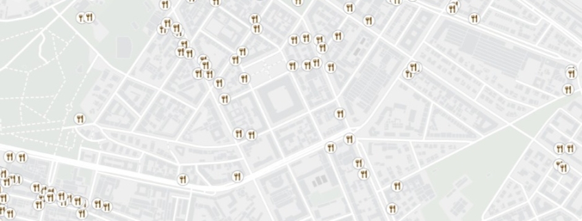
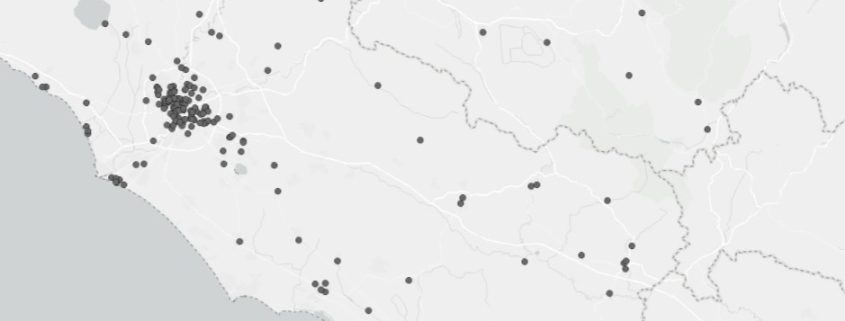
Point data related to food service establishments in Italy.

Point data related to food service establishments in Italy.
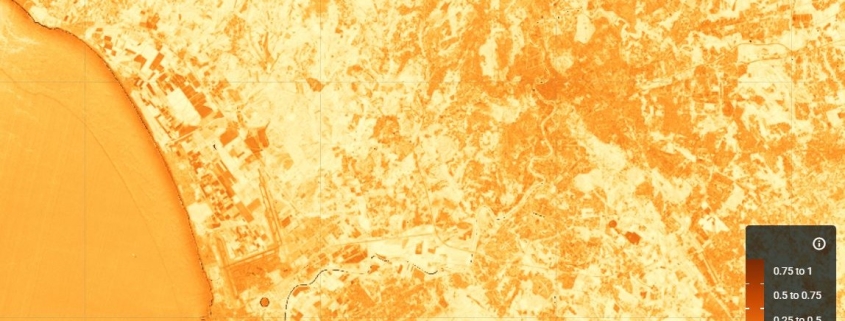
The NDBI (Normalized Difference Built-up Index) index uses the NIR and SWIR bands to highlight manufactured built-up areas.
Availability: Available
Data Type: raster
Delivery Method: API, Direct download
Compatible with: ArcGIS Enterprise, ArcGIS Online, ArcGIS Pro, QGIS
Piattaforms: Desktop, Web
System Requirements: None
Version: 1.0
Coverage Area: Italia
Data Format: Tiff, GeoTiff, .jpg, Excel, csv, .pdf
Sistema di riferimento: WGS 1984 UTM Zone 32N (EPSG: 32632)
Sources: Sentinel-2 Copernicus Programe
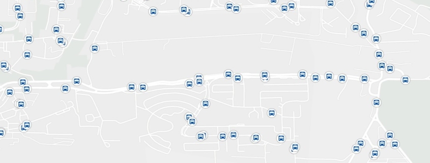
The dataset concerns the local public transportation network in Italian territory
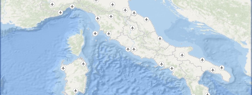
The dataset contains the exact location and main information concerning italian airports
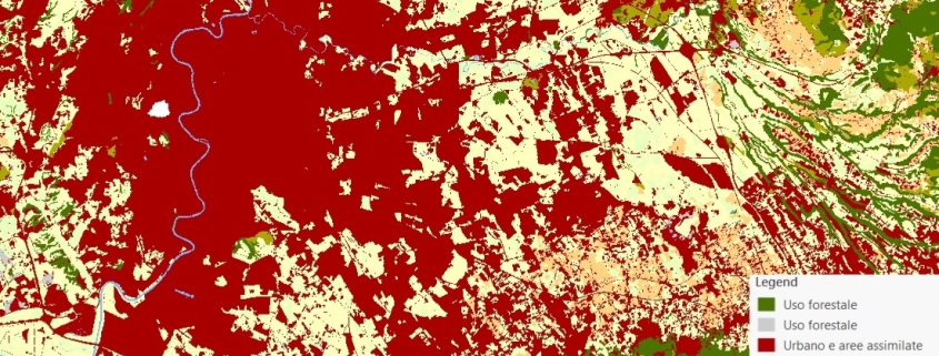
The land use map is obtained by the integration of data provided by the Land Monitoring Service of the Copernicus Program and by the National Report on Soil Consumption (ISPRA).
Availability: Available
Data Type: raster
Delivery Method: API, Direct download
Compatible with: ArcGIS Enterprise, ArcGIS Online, ArcGIS Pro, QGIS
Piattaforms: Desktop, Web
System Requirements: None
Version: 1.0
Coverage Area: Italia
Data Format: Tiff, GeoTiff, .jpg, Excel, csv, .pdf
Sistema di riferimento: WGS 1984 UTM Zone 32N (EPSG: 32632)
Sources: Sentinel-2 Copernicus Programe
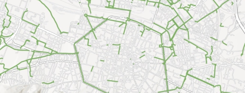
The dataset concerns the exact location of cycle paths in Italian territory
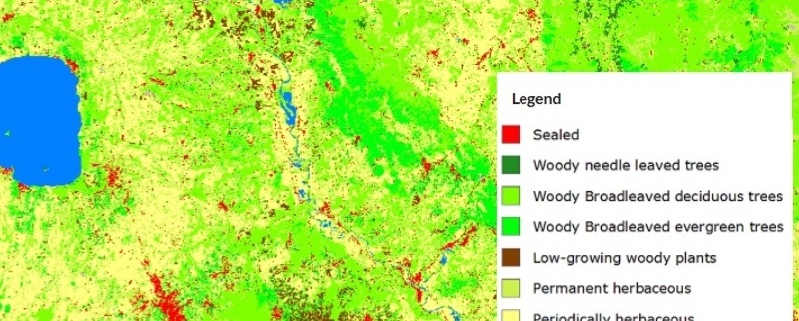
The land cover map is obtained from the combination of data provided by the Service of Land Monitoring of the Copernicus Program and by the National Report on Soil Consumption (ISPRA).
Availability: Available
Data Type: raster
Delivery Method: API, Direct download
Compatible with: ArcGIS Enterprise, ArcGIS Online, ArcGIS Pro, QGIS
Piattaforms: Desktop, Web
System Requirements: None
Version: 1.0
Coverage Area: Italia
Data Format: Tiff, GeoTiff, .jpg, Excel, csv, .pdf
Sistema di riferimento: WGS 1984 UTM Zone 32N (EPSG: 32632)
Sources: Sentinel-2 Copernicus Programe
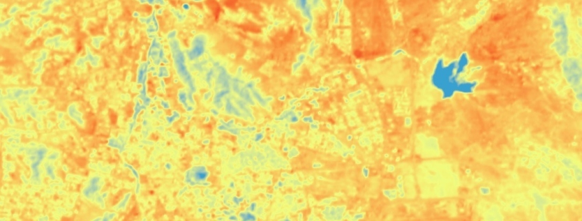
The raster data-set represents the Land surface temperature (LST) shown in Celsius degrees, calculated by Landsat 8-9 (thermal bands).
Availability: Available
Data Type: raster
Delivery Method: API, Direct download
Compatible with: ArcGIS Enterprise, ArcGIS Online, ArcGIS Pro, QGIS
Piattaforms: Desktop, Web
System Requirements: None
Version: 1.0
Coverage Area: Italia
Data Format: Tiff, GeoTiff, .jpg, Excel, csv, .pdf
Sistema di riferimento: WGS 1984 UTM Zone 32N (EPSG: 32632)
Sources: NASA/USGS Landsat Program
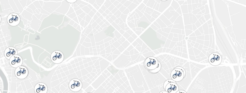
The dataset concerns the exact location of bicycle parkings in Italian territory
