
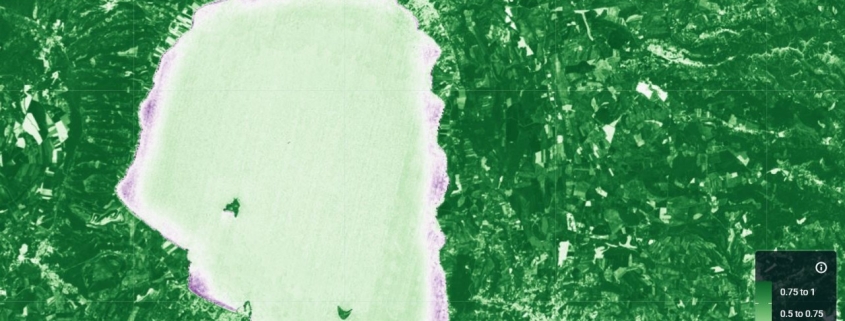
The NDCI index is used to assess the concentration of chlorophyll-a in water bodies.
Availability: Available
Data Type: raster
Delivery Method: API, Direct download
Compatible with: ArcGIS Enterprise, ArcGIS Online, ArcGIS Pro, QGIS
Piattaforms: Desktop, Web
System Requirements: None
Version: 1.0
Coverage Area: Italia
Data Format: Tiff, GeoTiff, .jpg, Excel, csv, .pdf
Sistema di riferimento: WGS 1984 UTM Zone 32N (EPSG: 32632)
Sources: Sentinel-2 Copernicus Programe
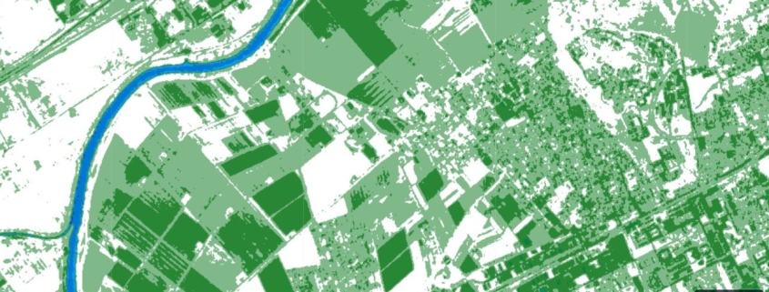
The NDWI index is used to detect and analyze water bodies in a satellite image by leveraging the NIR (near-infrared) and GREEN (visible green) spectral bands.
Availability: Available
Data Type: raster
Delivery Method: API, Direct download
Compatible with: ArcGIS Enterprise, ArcGIS Online, ArcGIS Pro, QGIS
Piattaforms: Desktop, Web
System Requirements: None
Version: 1.0
Coverage Area: Italia
Data Format: Tiff, GeoTiff, .jpg, Excel, csv, .pdf
Sistema di riferimento: WGS 1984 UTM Zone 32N (EPSG: 32632)
Sources: Sentinel-2 Copernicus Programe
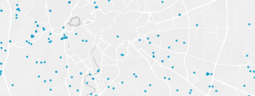
Italian internal water bodies
Availability: Available
Data Type: vector
Delivery Method: API, Direct download
Compatible with: ArcGIS Enterprise, ArcGIS Online, ArcGIS Pro, QGIS
Piattaforms: Desktop, Web
System Requirements: None
Version: 1.0
Coverage Area: Italia
Data Format: Kml, ESRI shapefile, ArcGIS Services, Geopackage, csv, Geojson
Sistema di riferimento: WGS 1984 UTM Zone 32N (EPSG: 32632)
Sources: MASE – Ministero dell’Ambiente e della Sicurezza Energetica

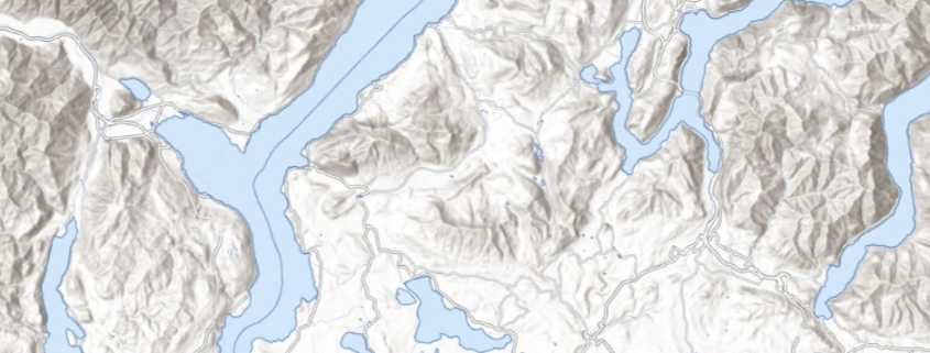
Italian hydrographic network
Availability: Available
Data Type: vector
Delivery Method: API, Direct download
Compatible with: ArcGIS Enterprise, ArcGIS Online, ArcGIS Pro, QGIS
Piattaforms: Desktop, Web
System Requirements: None
Version: 1.0
Coverage Area: Italia
Data Format: Kml, ESRI shapefile, ArcGIS Services, Geopackage, csv, Geojson
Sistema di riferimento: WGS 1984 UTM Zone 32N (EPSG: 32632)
Sources: MASE – Ministero dell’Ambiente e della Sicurezza Energetica
